+98 912 272 2656 info@persiatrek.com

Tochal

Tochal mountain

Alborz Mountains Overview

The Alborz Mountains form a dense, long and narrow chain that runs through northern Iran separating the Caspian Sea from the central plateau of Iran. The higher peaks of the Alborz exceed heights of 14 to 15 thousand feet with the 15912 ft (4850 m) summit of Mt. Alam (Alam kooh) as the range’s second highest peak. The dormant volcanic cone of Mt. Damavand soars far above the rest of the mountains to an elevation of 18606 ft (5671 m) forming the country’s highest peak. The proximity of the mountains to the Caspian Sea has created a steamy lush environment on the coastal plain and the northernmost slopes. The rest of the mountains, however, are mostly bare, limiting trees to the banks of the streams at the bottom of the valleys. Grasslands, alpine tundra and permanent snow cover the higher elevations. Winter brings a heavy coat of powdery snow several feet deep creating an ideal environment for skiing.

touchal

Tochal summit

(more…)

Mount Sabalan Trekking Guide

Mount Sabalan Trekking Guide

Mount Sabalan Trekking Guide

A Complete Guide to Iran's third Highest Peak

1. Introduction

If you’re looking for an unforgettable trekking experience, Mount Sabalan should be on your bucket list! As the third-highest peak in Iran at 4,811 meters (15,784 feet), this dormant volcano offers breathtaking landscapes, thrilling trekking routes, and a stunning crater lake at its summit.

With diverse flora, fauna, and natural hot springs, Mount Sabalan Trekking Guide is perfect for adventure seekers, nature lovers, and those eager to explore Iran’s rich nomadic culture. Whether you’re a seasoned mountaineer or a beginner looking for a challenge, this guide will help you plan the perfect trek!


2. Geographical and Geological Features

Mount Sabalan is located in Ardabil Province, northwestern Iran, near the city of Meshginshahr. It is part of the Alborz mountain range and is known for its volcanic formations and ice-covered summit.

Key Features:

  • Type: Dormant stratovolcano
  • Elevation: 4,811 meters (15,784 feet)
  • Famous for: A permanent crater lake at the summit, one of the highest lakes in the world
  • Landscape: Rocky volcanic formations, alpine meadows, and snow-covered peaks

sabalan tour


3. Climate and Best Time to Visit

Mount Sabalan experiences harsh winters and cool summers, making it essential to plan your trek during the right season.

Seasonal Trekking Guide:

  • Summer (June–September):Best time to climb – clear skies, mild temperatures, and safe trails.
  • Autumn (October–November):Risky – increasing snowfall and unpredictable weather.
  • Winter (December–March):Not recommended – extreme cold, snowstorms, and dangerous conditions.
  • Spring (April–May):Challenging – melting snow creates slippery trails, but the landscape is beautiful.

👉 For the best trekking experience, visit between June and September.


4. Trekking Routes to the Summit

There are three main routes to reach the summit, each offering different levels of difficulty and scenic views.

Mount Sabalan Trekking Guide

a) The Northeast Route (Shabil Route) – Most Popular

Best for first-time trekkers
Has a shelter at 3,600 meters
Starts from Shabil Hot Springs (2,700 meters)

This is the easiest and most commonly used route, with a well-marked trail leading to the summit.

b) The Western Route – More Challenging

Requires better navigation skills
Fewer trekkers, more solitude
Offers diverse landscapes

This route provides stunning views but is harder to navigate due to steep climbs.

c) The Southern Route – Most Difficult

Only recommended for experienced climbers
Involves technical climbing
Offers the most direct ascent

This is the least used route and requires expert mountaineering skills.


5. Difficulty Level and Trekking Challenges

Mount Sabalan is considered a moderate to difficult trek, depending on the route.

Challenges:

  • Altitude sickness – Acclimatization is crucial above 3,500 meters.
  • Steep, rocky terrain – Proper footwear and trekking poles are essential.
  • Cold temperatures – Even in summer, temperatures drop below freezing at night.

💡 Tip: Stay at the 3,600-meter shelter overnight to adjust to the altitude before the summit push.


6. What to Pack for Mount Sabalan Trekking

Must-have gear for a safe and comfortable trek:

Clothing:

✔ Insulated jacket & warm layers
✔ Waterproof hiking boots
✔ Sunglasses & sunscreen
✔ Gloves and a hat

Equipment:

✔ Trekking poles
✔ Headlamp
✔ Sleeping bag (if camping)

Food & Hydration:

✔ High-energy snacks
✔ At least 3 liters of water per day


7. The Summit and Crater Lake Experience

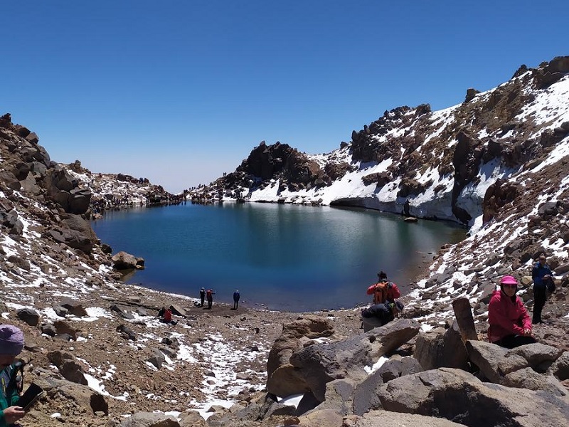
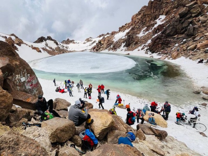
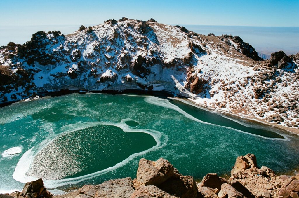
The highlight of the trek is reaching the summit, where you’ll find a spectacular frozen crater lake.

Mount Sabalan Trekking Guide

  • Size: 80 meters in diameter
  • Frozen most of the year
  • Incredible sunrise and panoramic views

The breathtaking landscapes make all the effort worth it!


8. Attractions Around Mount Sabalan

  • Shabil Hot Springs – Perfect for relaxing after a long trek.
  • Nomadic peoples – Experience Iran’s Shahsavan nomadic culture.
  • Meshginshahr Suspension Bridge – One of the highest in the Middle East.

9. Accommodation and Camping Options

sabalan

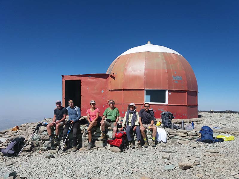
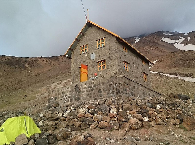
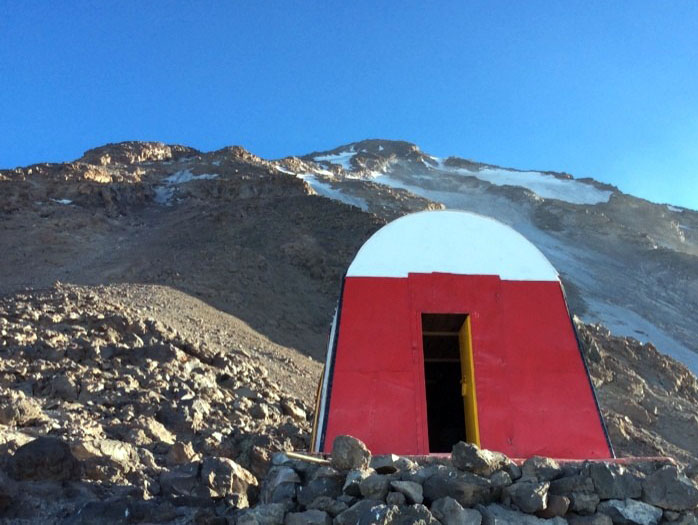
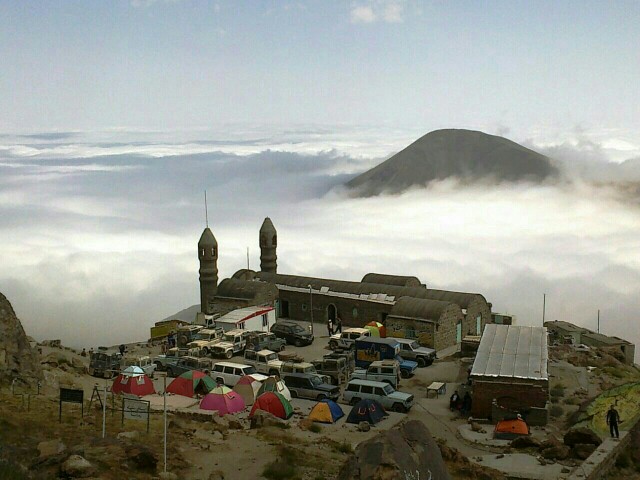
eastern shelter of Sabalan

Shelter at 3,600 meters – Basic but useful for acclimatization.
Camping – Best near Shabil Hot Springs.
Hotels in Ardabil & Meshginshahr – For those preferring comfort.


10. How to Reach Mount Sabalan

🚗 From Ardabil: 90 km drive (2 hours) to Shabil village.
By Air: Flights from Tehran to Ardabil Airport (ADU).
🚌 By Bus: Tehran to Meshginshahr (6-7 hours), then taxi to Shabil.


11. Safety Tips for Trekkers

Check the weather before your trek.
Trek with a group or hire a guide.
Acclimatize properly to avoid altitude sickness.
Pack enough water, food, and warm clothing.


12. Environmental Conservation and Responsible Trekking

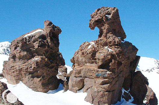
sabalan eagle statue

sabalan eagle statue, the famous symbol of Sabalan

Follow Leave No Trace principles.
Respect local communities and wildlife.
Use eco-friendly gear and avoid plastic waste.


13. FAQs

 What is the best time to climb Mount Sabalan?

The best time to climb is June to September, when the weather is most stable.

Do I need a permit to hike Mount Sabalan?

No special permits are required for general trekking, but hiring a guide is recommended.

3. Is Mount Sabalan suitable for beginner hikers?

Yes, especially the Northeast Route, which is considered the easiest.

Are there any accommodations near Mount Sabalan?

Yes, hotels in Ardabil and Meshginshahr, as well as camping near Shabil Hot Springs.

What makes Mount Sabalan unique compared to other mountains in Iran?

Its frozen crater lake, healing hot springs, and spiritual significance make it a special destination.

mount Sabalan lake

mount Sabalan lake


14. Conclusion

Mount Sabalan is an incredible destination for nature lovers, trekkers, and cultural enthusiasts. From its breathtaking crater lake to its rich history and vibrant local communities, this mountain offers an unforgettable experience. Whether you’re looking to challenge yourself with a climb, soak in hot springs, or explore the nomadic lifestyle, Sabalan has something for everyone.

If you love adventure and stunning landscapes, Mount Sabalan should be on your bucket list!

🌍 Mount Sabalan Trekking Guide offers an unforgettable adventure in Iran’s stunning landscapes. Plan your journey today!


sabalan tour
4-Day Trekking Sabalan , Third Highest Peak in Iran

From 380$

See Details

Iran trekking tour
4-Day Alamkuh Trekking Tour , Second Highest Peak in Iran 

From 450$

See Details

Damavand trekking tour
15-Day Trekking Damavand , Alamkuh , Sabalan

From 1400$

See Details

Damavand trekking tour
6-Day Trekking Damavand South Route

From 620$

See Details

mount damavand
9-Day Trekking Damavand & Alamkuh

From 930$

See Details

touchal
6-Day Trekking Damavand &Touchal

From 670$

See Details

Damavand trekking tour
4-Day Trekking Damavand- Economy Tour

From 400$

See Details

damavand northeast route
6-Day Trekking Damavand Northeast Route

From 700$

See Details

mount damavand climb
6-Day Trekking Damavand West Route

From 650$

See Details

mount damavand climb
6-Day Trekking Damavand North Route

From 750$

See Details

mount damavand climb
6-Day Trekking Damavand Northwest Route

From 800$

See Details

No Results Found

The page you requested could not be found. Try refining your search, or use the navigation above to locate the post.

zardkooh , a mountain range in Zagros

Zard kooh – e – Bakhtiary

Introduction

Before talking about Zard kooh lets see where it is located at, in a major scope.
Iran has two main large mountain ranges Alborz and ZagrosAlborz includes the most higher peaks of the land and stands as a east-west strip at north, but Zagros mountains have a different profile and shape, a much more vast north-west to south-east mountain range that covers the whole west part of the country, any way as you can even see in the SP Alborz mountains are the most known and introduced. That’s probably because Alborz range is near the capital Tehran and under the Caspian shore, where more people, climbers and tourists travel.

The Zagros mountains are the major mountain system of western Iran. They consist of high parallel ranges with sheer rugged peaks, separated by steep canyons and gorges. Several summits rise to over 14,000 feet, the highest being Dena(sub-range)->Ghash-e-Mastan peak (14,920 ft./ 4548m) *.
Heavy snow falls in Winter and remains on the higher summits for much of the year. One of the most spectacular areas of the Zagros is the area surrounding the headstreams of the Karun River and its tributaries. Here, the rivers tumble through rocky gorges, sheer mountain walls towering above them. Also of interest, in the center of the range, are the numerous salt domes, some rising up to 5,000 feet.

(more…)

Oshtoran kooh

Oshtoran kooh , A mountain range in Zagros

Iran popular mountain

Oshtoran kuh mountain range

Overview

Before talking about Oshtoran Kooh lets see where it is located at, in a major scope.
Iran has two main large mountain ranges Alborz and ZagrosAlborz includes the most higher peaks of the land and stands as a east-west strip at north, but Zagros mountains have a different profile and shape, a much more vast north-west to south-east mountain range that covers the whole west part of the country, any way as you can even see in the SP Alborz mountains are the most known and introduced. That’s probably because Alborz range is near the capital Tehran and under the Caspian shore, where more people, climbers and tourists travel.

(more…)

Bakhtiari groups

Bakhtiari groups

Bakhtiari groups

zagros trek

Bakhtiari groups : You have probably heard the name of Soraya Bakhtiari, the Iranian-German queen of Iran, or Shapur Bakhtiar, the last prime minister of the Pahlavi kingdom.

What about the NFL Green Bay Packers player David Bakhtiari? All of them are members or descendants of the Bakhtiari groups.

(more…)

Mount Alam kuh climbing guide

Mount Alam kuh climbing guide

Mount AlamKuh Climbing Guide

A Complete Guide to Iran's second Highest Peak

Introduction to Mount Alam kuh climbing guide


mount Alam kuh

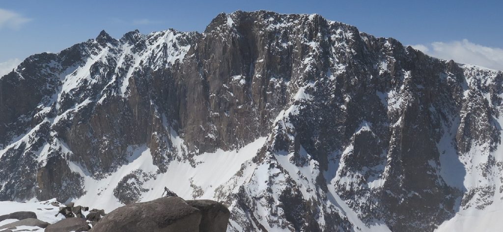
Mount Alam Kuh is a breathtaking peak in northern Iran, standing as the second highest mountain in the country after Mount Damavand. This magnificent mountain is famous for its majestic north wall, vast glaciers, and stunning landscapes, making it a top destination for mountaineers and adventure seekers. The unique geographical and geological features of Mount Alam Kuh attract professional climbers, nature enthusiasts, and researchers from all over the world.

In this comprehensive Mount Alamkuh climbing , we will explore Mount Alam Kuh in detail, covering its elevation, geographical location, ascent routes, climbing tips, weather conditions, maps, and other essential information to help adventurers plan their journey effectively.


Where is Mount Alam Kuh?

Mount AlamKuh is located in the western Alborz mountain range, within the Takht-e Soleiman region. This spectacular peak is situated in Mazandaran Province, near the city of Kelardasht.

Damavand and Alamkuh climbing tour

How to Reach Mount Alam Kuh

The best way to access Mount Alam Kuh is through Rudbarak, a scenic village in Kelardasht that serves as a base camp for climbers. Rudbarak is well-connected by road to Tehran and other major cities, making it a convenient starting point for expeditions.

To reach Rudbarak from Tehran:

  • Drive from Tehran to Chalus (about 200 km, approximately 4 hours)
  • Continue to Kelardasht, a beautiful mountain town known for its lush forests and cool climate
  • Proceed to Rudbarak, the main hub for climbers heading to Mount Alam Kouh

From Rudbarak, mountaineers typically proceed to Vandarbon, where they prepare for their ascent and begin their trek.


Elevation and Geographical Features of Mount Alam Kuh

The summit of Mount Alam Kuh stands at an elevation of 4,848 meters (15,906 feet), making it the second-highest peak in Iran. Its imposing granite walls, rugged ridges, and vast glaciers make it one of the most challenging climbs in the Middle East.

The Takht-e Soleiman region, where Mount Alam Kouh is located, features 35 to 40 peaks above 4,000 meters, creating a dramatic and awe-inspiring landscape for climbers and trekkers.


Climate and Best Time to Visit

Weather Conditions at Mount Alam Kuh

Due to its high altitude and alpine environment, the climate on Mount Alam Kouh varies significantly throughout the year:

  • Summer (June to September): Best time for climbing, with stable weather and minimal snowfall
  • Winter (December to March): Extreme cold and heavy snowfall, suitable only for expert climbers
  • Spring and Autumn: Unpredictable weather, with possible snow and rain

Best Season for Mount Alamkuh climbing

The optimal climbing season is from late June to early September, when temperatures are moderate, and routes are more accessible.

Alamkuh trekking


Glaciers of Mount Alam Kuh

Mount Alam Kuh is home to some of Iran’s largest and most significant glaciers, contributing to its reputation as a mountaineering paradise. The western side of the Alborz mountain range hosts numerous glaciers, extending from Taleghan Valley to Abbas Abad and Shahsavar jungles. These glaciers play a vital role in Iran’s water supply and serve as a critical research area for climate scientists.

Major Glaciers of Mount Alam Kuh:

  • Sarchal Glacier
  • Alamchal Glacier
  • Takht-e Soleiman Glacier
  • Marji-Kash Glacier
  • Haft Khan Glacier
  • Chaloon Glacier
  • Khersan Glacier
  • Shaneh Kuh Glacier
  • Split Glacier

These glaciers provide a challenging and scenic landscape for experienced ice climbers and mountaineers, making Mount Alam Kuh a must-visit destination for extreme adventurers.


Mount Alam Kuh Climbing Routes

Since Mount Alam Kuh is connected to various surrounding mountains, multiple routes lead to the summit. These routes range from moderate trekking paths to highly technical climbing routes that require specialized equipment and skills.

1. The Southern Face Route (Hesarchal) – The Easiest Route

This is the most accessible and commonly used trail for  Mount Alam Kuh climbing .

Mount Alamkuh

Route Details:

  • Starting point: Rudbarak → Vandarbon → Tang-e Galoo (3,300m)
  • Resting point: Hesarchal plain (3,750m)
  • Total ascent time: Approximately 6 hours (1.5 hours to Hesarchal, 4.5 hours to the summit)
  • Recommended for: Beginner and intermediate trekkers

This route offers scenic views of Hesarchal Valley and is less technical than the northern routes, making it ideal for first-time climbers.


2. The Northern Face Route (Siah Sang) – A Challenging Trekking Route

The Siah Sang route is one of Iran’s most demanding Mount Alam Kuh climbing paths, requiring endurance and mountaineering experience.

Route Details:

  • Starting point: Rudbarak → Vandarbon
  • Trail: Vandarbon → Sarchal Hut (3,700m) → Alamchal → Siah Sang Pass
  • Total ascent time: Approximately 12 hours (Day 1: 6 hours to Sarchal Hut, Day 2: 6 hours to the summit)
  • Recommended for: Experienced hikers

This route often includes an overnight stay at Sarchal Hut, making it a more extended and physically demanding climb.


3. The German Flank Route – A Technical Climb

This northern route is shorter than Siah Sang but requires technical climbing skills and proper gear.

Mount Alam kuh , Germand ridge

Route Details:

  • Starting point: Rudbarak → Vandarbon
  • Trail: Vandarbon → Sarchal Hut → Alamchal → German Flank
  • Required Equipment: Technical climbing gear
  • Recommended for: Skilled climbers with experience in technical ascents

4. The Northern Big Wall Routes – For Rock Climbing Enthusiasts

The Northern Big Wall of Mount Alam Kuh is Iran’s most famous rock-climbing destination, featuring some of the most challenging vertical climbs.

mount Alam kuh 5

Siah sangha route

Popular Mount Alam Kuh climbing Routes:

  • The Italian Route
  • The Polish Route
  • The French Route
  • Harry Rost Route
  • Arash Route
  • Hamedani Route

These routes require advanced rock climbing skills and extensive preparation.


Conclusion

With its majestic glaciers, diverse climbing routes, and breathtaking landscapes, Mount Alam Kuh is an unparalleled adventure destination. Whether you’re a beginner looking for a rewarding trek or an expert seeking a technical challenge, Mount Alam Kuh offers an unforgettable experience in Iran’s stunning alpine wilderness.

No Results Found

The page you requested could not be found. Try refining your search, or use the navigation above to locate the post.

Mount Alam Kuh Tours

Iran trekking tour

4-Day Alamkuh Trekking Tour , Second Highest Peak in Iran 

From 450$

See Details

mount damavand

9-Day Trekking Damavand & Alamkuh

From 930$

See Details

Damavand trekking tour

15-Day Trekking Damavand , Alamkuh , Sabalan

From 1400$

See Details

× How can I help you?