No Results Found
The page you requested could not be found. Try refining your search, or use the navigation above to locate the post.

The Zagros Mountain Range is a prominent and historically significant mountain range that stretches across western Iran and extends into northern Iraq and southeastern Turkey. Known for its breathtaking landscapes, diverse ecosystems, and cultural heritage, the Zagros plays a vital role in the region’s ecology, history, and economy. This detailed guide explores the various facets of the Zagros Mountain Range, shedding light on its geography, history, ecology, and contemporary significance.
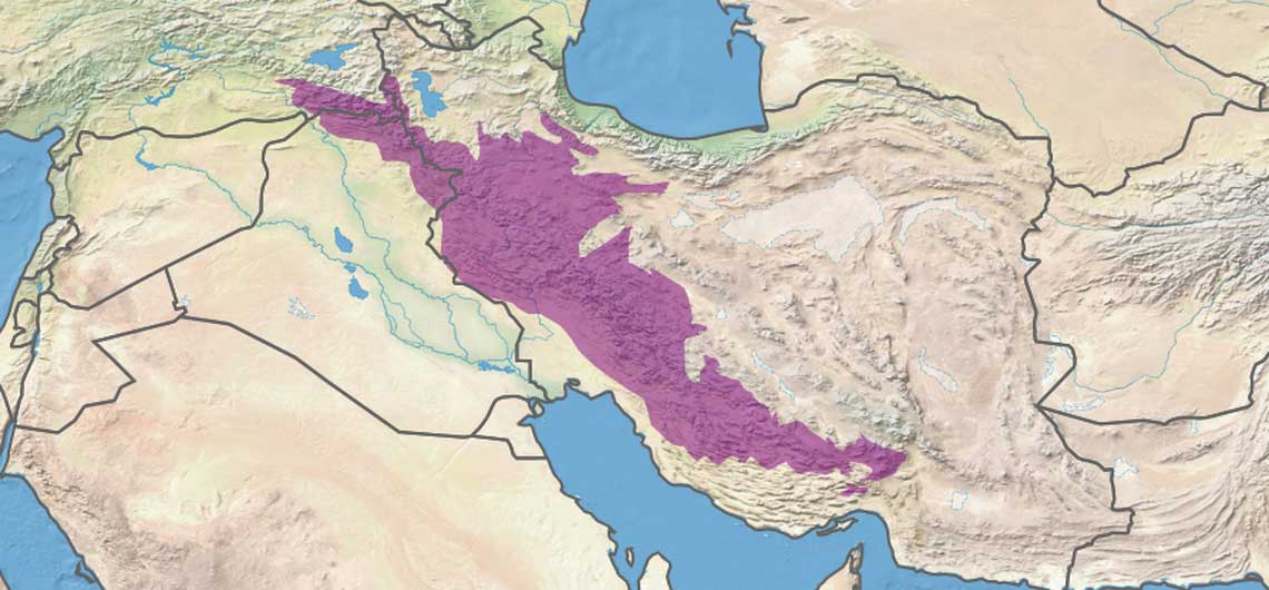
The Zagros Mountain Range is a striking feature of the Middle Eastern landscape, stretching from the northwest to the southeast of Iran. At its southern end, the range passes along the eastern coasts of the Persian Gulf and extends into Baluchestan, Afghanistan, and the sparsely populated coastal areas of the Indian Ocean. Ultimately, it connects with the Hindu Kush Mountains, separating from the Pamir range.
The Zagros spans approximately 1,250 kilometers in length and varies in width from 160 to 360 kilometers. The range is primarily composed of folded sedimentary rocks, including limestone, sandstone, and shale. This geological formation resulted from the collision of the Arabian and Eurasian tectonic plates during the Pliocene era. This process not only shaped the range but also contributed to the rich sedimentary deposits found in the region today.
The Zagros Mountain Range is deeply intertwined with human history. Archaeological evidence suggests that humans have inhabited this region for tens of thousands of years. Some of the earliest agricultural settlements, dating back to 10,000 BCE, were located in the fertile valleys of the Zagros. These early communities pioneered the domestication of plants and animals, laying the foundation for human civilization.
Over millennia, the Zagros has served as a cultural crossroads, hosting numerous civilizations, including the Elamites, Assyrians, Medes, and Achaemenids. The mountains provided both a refuge and a strategic advantage, influencing trade, warfare, and cultural exchange.
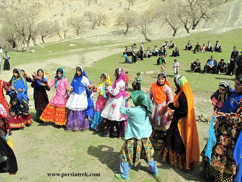
In modern times, the Zagros remains home to diverse ethnic groups, including Kurds, Lors, Bakhtiaris, and Lak nomads. Each of these groups has a unique cultural heritage, expressed through their languages, music, clothing, and traditions. The mountains continue to be a symbol of resilience and identity for these communities.
The Zagros is characterized by its diverse topography, ranging from rolling hills to towering peaks. The highest points in the range are found in the Dena Mountains, with Ghashmastan being the tallest at 4,435 meters above sea level. Other notable peaks include the Zardkooh Bakhtiari and Mount Dena, both of which attract climbers and adventurers from around the world.
The climate of the Zagros varies significantly depending on altitude and location. Generally, the range experiences a semi-arid to Mediterranean climate, with hot, dry summers and cold, wet winters. Snowfall is common at higher elevations, contributing to the region’s water resources. The Zagros acts as a natural water reservoir, feeding major rivers such as the Karun, Karkheh, and Diyala, which are essential for agriculture and human settlements.

The Zagros Mountain Range is a hotspot for biodiversity, boasting a wide variety of flora and fauna adapted to its diverse climates and elevations.
The vegetation of the Zagros is rich and varied, encompassing over 2,000 plant species, many of which are endemic. The lower elevations are dominated by oak forests, particularly Persian oak (Quercus brantii), which cover approximately 10 million hectares. Wild pistachio trees and almond species are also common. These forests play a critical role in maintaining soil stability, regulating climate, and supporting local economies.
The wildlife of the Zagros is equally diverse. Mammals such as Persian leopards, Asiatic black bears, and wild goats inhabit the rugged terrain, while bird species like eagles, vultures, and partridges soar above. Conservation efforts are ongoing to protect endangered species and their habitats, although challenges such as deforestation and hunting persist.
The Zagros Mountain Range can be divided into three main sections:
The northern section of the Zagros is relatively smaller but no less significant. It stretches from the Cesar River Valley in the north and west to the Zalki and Kogan rivers in the south. Key features of this region include:
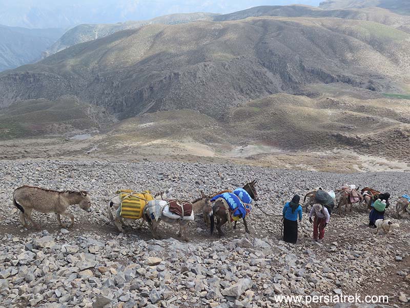
Bakhtiari nomads migration
Central Zagros is a vast and diverse area where Bakhtiari nomads and the Haft Lang group traditionally reside. Its boundaries extend from the Ab Zalki and Ab Zareh rivers in the north to the Karun and Shalmzar rivers in the south. Notable subregions include:
The southern section of the Zagros extends to Larestan and features a warm climate with annual precipitation averaging 250 millimeters. This region includes large areas of rangeland, supporting livestock farming, hunting, and dry farming. Key areas include:

The Zagros Mountain Range is a cornerstone of the region’s economy. Its rich natural resources, including oil, gas, and minerals, make it a vital contributor to Iran’s energy sector. The fertile valleys and plateaus support agriculture, with crops like wheat, barley, fruits, and nuts being cultivated. Livestock farming is another crucial activity, with sheep and goats being the primary animals raised by local communities.
Tourism is an emerging industry in the Zagros, driven by its natural beauty, cultural heritage, and recreational opportunities. Activities such as trekking, mountaineering, and exploring historical sites attract visitors from around the world. However, sustainable tourism practices are essential to preserve the fragile ecosystems and cultural integrity of the region.

The Zagros faces numerous challenges, including deforestation, overgrazing, and urbanization. Climate change exacerbates these issues, leading to reduced water availability and increased risks of natural disasters such as landslides and floods.
Conservation efforts are underway to address these challenges. Reforestation projects, wildlife protection programs, and sustainable land management practices are being implemented by governments and NGOs. Local communities play a crucial role in these initiatives, leveraging traditional knowledge to promote ecological balance.

The Zagros Mountain Range is a marvel of nature and a testament to human resilience and adaptability. Its towering peaks, fertile valleys, and rich biodiversity make it a unique and invaluable part of the Middle East. By addressing the challenges facing the region and promoting sustainable development, we can ensure that the Zagros continues to thrive for generations to come.
Whether you are a nature enthusiast, history lover, or adventure seeker, the Zagros Mountain Range offers something extraordinary. Explore its beauty, learn from its history, and contribute to its preservation.
The page you requested could not be found. Try refining your search, or use the navigation above to locate the post.
Plateau of Iran resembles a triangle between two recesses. Western and northern parts of this triangle are limited to Zagros and Alborz mountain ranges respectively.
Zagros mountains extends from NW to SE of Iran. At its far southern end, after passing along the eastern coasts of Persian Gulf, Baluchestan an Afghanistan and the sparsely populated coastal areas of Indian Ocean, it turns to join Hendukosh Mountains separating from Pamir.
Like other highlands of Iran, Zagros is the result of orgenetic movements during Pliocene era. During this period, sea water retreated from Iran’s mainland for the last time, leaving behind thick layers of sedimentary conglomerates.

Karkas mountain chain is located in Central Iran. It ranges from Kashan to Ardestan over more than 100 km and is mainly composed of igneous (plutonic and volcanic), pyroclastic and somewhat sedimentary Tertiary rocks. In the central part, this mountain chain consists of a Precambrian-Paleozoic basement.
The highest peak of the Karkas Mountains is 3895m which is close to Natanz.
Although in Persian Karkas means vulture, it is possible that the name of this mountain chain is derived from the settlement activity of ancient Kassites in the area, since in the ancient Assyrian language Kar-Kassi means “town or land of the Kassites” (modified interpretation after Roman Ghirshman, 1954).
Zagros trek : This film shows one of our exciting trips to Zagros, which took place in April 2018.
In this trip, we moved for 7 days in one of the important routes of Bakhtiari group and enjoyed the beautiful views of the pristine and wild mountains of Zagros.
We started our journey ( Zagros trek) from Lirok village at the end of Bazaft valley and after crossing the great Bakhtiari river and visiting the mountain lake of Tembi, we crossed the Selili pass at an altitude of 2800 meters and continued our movement towards the Durak region in northern Khuzestan. We observed this nomadic migration route, which is one of the most beautiful areas of the Zagros.
SEE ZAGROS TREKKING TOUR PACKAGE HERE
Dorfak Peak is undoubtedly one of the most beautiful mountains in Iran and one of the tourist destinations of Gilan province. This mountain is actually a dormant volcano.This peak is located twenty-seven kilometers northeast of Rudbar city at an altitude of 2733 meters and continues to the valley of three thousand Tonekabon.
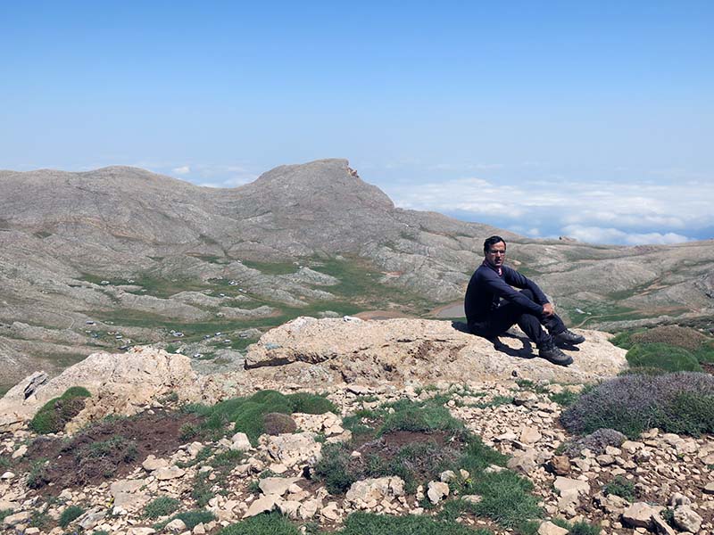
top of Dorfak
Taftan and heights around it, are known as heights of Khash area located at Iran’s Sistan and Beluchistan province. The province of Sistan and Baluchistan is located in the south-eastern part of the Iran and has an area of 181, 578 sq.km. Though it is the third largest province of the country, it is sparsely populated.
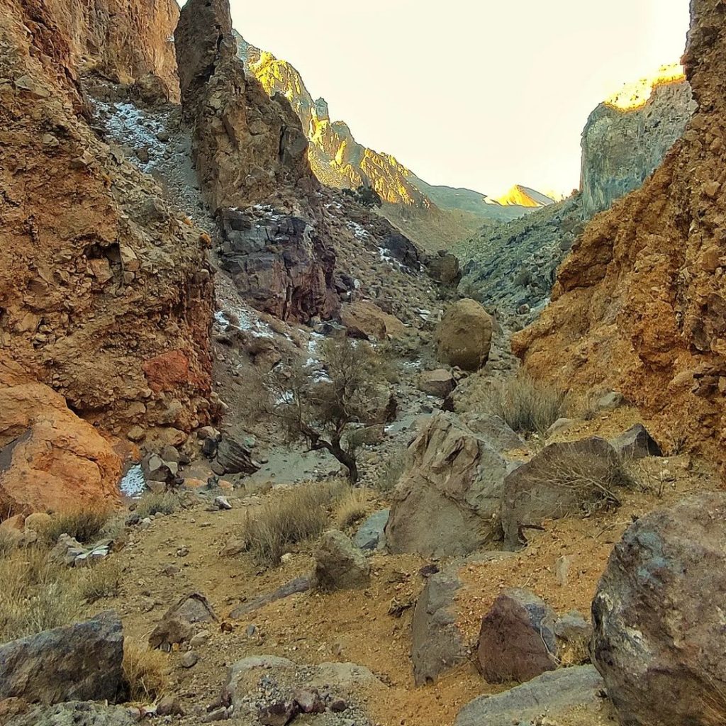
Taftan route