Mount Damavand , the highest volcano of Asia
Introduction
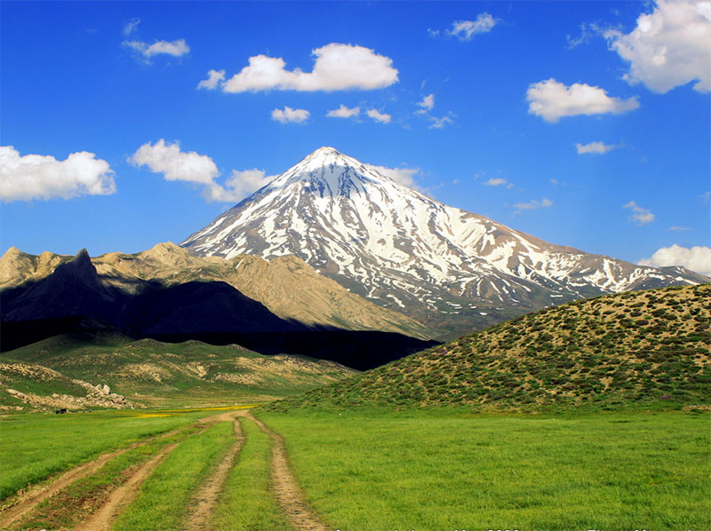
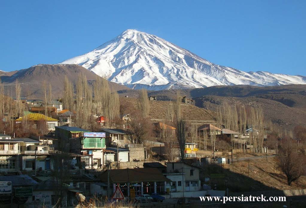
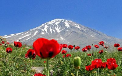
Mount Damavand is the name of a mountain in north of Iran plateau . it is located in the central part of Alborz mountain range. mount Damavand is a potentially active volcano and also it is the highest peak in Iran and also the highest volcano in Asia (about 5671m).
Mount Damavand Location:
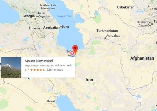
It is between Tehran and the southern coast of the Caspian Sea , in Amol County, Mazandaran Province, 69 km northeast of the city of Tehran and 62km southwest of Amol county.
Damavand as a volcano:
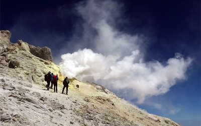
the biggest smoke vent on 5550mMount Damavand is a potentially active volcano , the first volcanic eruption of this mountain estimated on 1.78 million years ago. But maximum eruption refer to about 600000 to 280000 years ago. The last important eruption that made mount Damavand a high mountain was occurred about 10000 years ago.
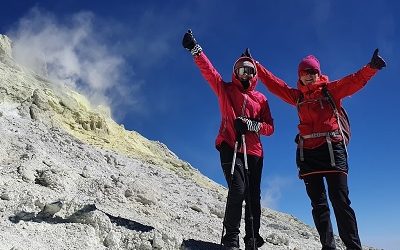
Crater diameter is about 400 meters and it’s covered by ice and hard snow all the time.
There are lots of hot hot springs on the lower slopes (biggest one in Ab-e Garm village in Larijan region) and hot sulfur gases emerging near the crater.
These thermal springs at the base and steam vents on the top indicate that a hot magma body is present beneath near the surface of the earth which indicates that this volcano is a little active.
Damavand highlights:
- The 12th most prominent peak in the world.
- The third most prominent in Asia after Mount Everestand Puncak Jaya.
- The highest volcanic mountain in Asia, and part of the Volcanic Seven Summits mountaineering challenge.
Damavand routes:
There are about 16 known routes to the summit with different level of difficulty, risk and accessibility .there are four popular route which have shelter and hut in midway and also are more safe and easy : Southern, Northern, Northeastern and western routes.
Here I give you some information about this routes:
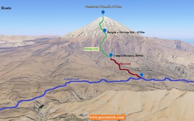
Southern route:
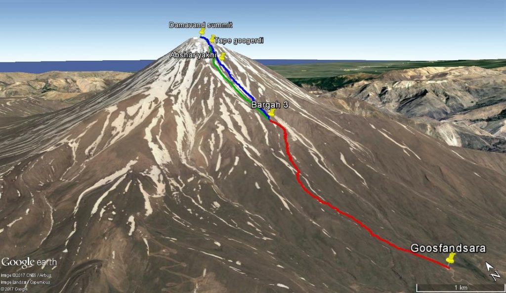
The most popular and also oldest and easiest route , which has steps and a camp midway called Saheb-e Zaman mosque(Goosfandsara) at 3000m and Bargah3 Camp/Shelter at 4,256 m .
You can access to this route by 2 hours driving from Tehran along Haraz road to Larijan region. Haraz road is one of the main roads that connect Tehran to Caspian sea.
You can access to southern ridge of Damavand from two villages in Larijan: Polur(2200m) and Reyneh(2300m).
There is a road between Polur and Reyneh and in the middle of this road at 2450 high there is a parking that is open only in summer . in winter you should start trekking from this point. First camp is Saheb-e Zaman mosque at 3120m (end of road) and summer start point for trekking .
The last camp is Bargah Sevom at 4256m . in this area there is a big Hut equipped by kitchen , shop , toilet and also there is an old shelter and plenty of tent place.
Western route:
This route is the second popular route of Damavand , To access this route you should drive along Haraz road to Polur then dive by 4WD on a dirt road about 1 hours to start point of western road(3250m). there is a big shelter (Simorgh) with 2 floor on 4200m high of this route .
Northern route:
The third popular route of mount Damavand is also the most difficult one , there are two small shelter on 3900m and 4800m high . to access this route you should along Hraz road and 60km before Amol you should continue on a byroad toward Nandal and Miandeh villages(20km) . Nandal(2300m) is the last village and there is some local house (Salehi house) for accommodation .
After 40 min driving from Nandal on a dirt road you will reach to Gosfandsar(2910m) and start trekking.
North-eastern route:
The longest route of mount Damavand and also the most beautiful one , by ascending Damavand from this route you will have the chance of visiting the biggest glacier of Damavand(Yakhar). there are one shelter on 4400m high (Takht-e Fereydoon). to access this route you should along Hraz road and 80km before Amol you start your trekking from Gazaneh(1650m) village
You can find our Damavand packages here:

Mount Damavand History

Damavand Volcanic Crater
Руководство по восхождению на гору Дамаванд
Mount Damavand Climbing Guide
Mount Damavand Trekking Guide
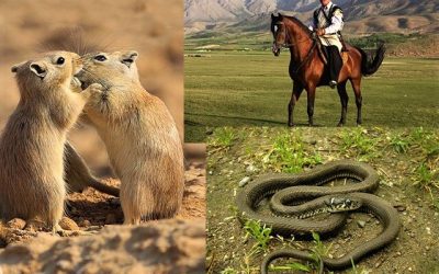
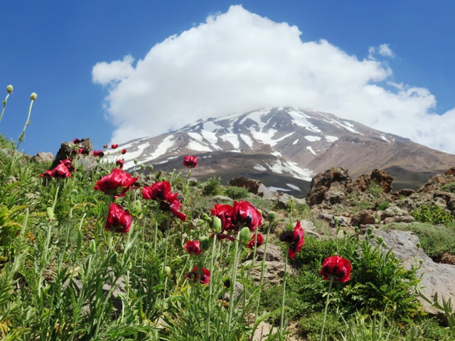
Damavand’s Flora and Fauna
Damavand Sulfur Hill
Damavand Hot Water Springs

Iran Adventure Tour

Discover Dasht-e Lut Desert

The Ultimate Guide to the Best Deserts in Iran