by PersiaTrek | 28 Mar 2022 | alamut, Articles, Mountaineering
Alamut Valley Travel Guide
History
Alamut refers to an isolated valley lying between Siah lan on the north, and Alborz, and Qazvin mountains on the south. Etymologically, the name Alamut means “trained eagle” or, as some sources say, the eagle’s nest. Actually, there is a story behind this etymology. According to the story, once an eagle guided a Daylamite ruler to find this strategic site.
By the way, based on more concrete historical evidence, this fortress was part of the Buyid territory and one of the Daylamite kings constructed it in 860 AD.
Later in the Seljuk era, because of being seriously repressed by the government, Isma’ilis (a branch of Shia Islam) seized and rebuilt several fortresses, mainly in Tabas, Khorasan, Khuzestan, and Syria to practice their religious rituals and traditions.

(more…)
by PersiaTrek | 25 Mar 2022 | Articles, desert trekking, Mountaineering
Lut desert
Introduction
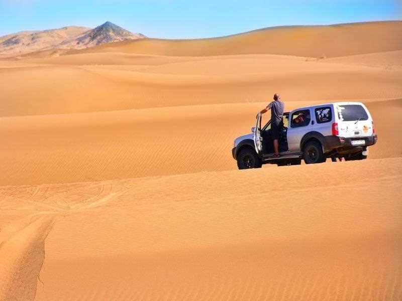
Lut is a vast desert that covers about 10% of Iran. Lut Desert is one of the hot and dry regions of the world with an area of 120,000 square kilometers. This region is full of unknowns. This scorching and mysterious area has been so attractive that it is registered as the first natural monument of Iran in the UNESCO list of natural heritage.
Lut is located in the southeast of Iran and gets the title of the most pristine spot in Iran. “Lut” in Baluchi language, which is one of the languages of northwestern Iran, means naked, waterless, thirsty and empty of everything. The main part of this great desert is made up of sand and gravel and other parts of it have desert geography.

(more…)

by PersiaTrek | 22 Mar 2022 | Articles, desert trekking, Mountaineering
Twelve hiking trails in Iran that must be visited
Lake Neor

One of the most beautiful hiking trails in Iran and a kind of lost paradise, is located between Guilan province and Ardabil province . This region is not really comparable to any other place in Iran in terms of natural beauty. Every corner of nature in this area will surprise you with a new attraction. One of the natural beauties of this region is called Lake Nevar. Lake Noor, located near the village of Abbasabad, is one of the best hiking trails in Iran.
You can only choose this path for walking if you are physically fit. This is a fairly mountainous hiking trail but it can not be climbed. You will climb various hills to reach your destination. Many hiking and hiking people camp here to enjoy the nature of the area.
There are generally five hiking trails in the area. The two routes start from Khalkhal and Ardibel. But the other three paths all start from Hashtpar Talesh. On your way, you will visit Subatan, Varzan waterfall, Shile Vasht, Sheblu, Honi nettle and all these beautiful and captivating areas. Above the heights of this route, you will see amazing views that are really worth seeing.
(more…)
by PersiaTrek | 16 Mar 2022 | Articles, Mountaineering
Sahand mountain , the bride of mountains in Iran

Sahand mountain
Overview
Sahand Mountain (Kuh-e Sahand) with the height of 3707 meters (12,162 ft) is the highest mountain in East Azarbaijan Province, in addition to being an important dormant volcano in the country.
The Sahand mountains length are about 50 km located in south of Tabriz, the highest peak of which is Jam Daqi at an attitude of 3,750 m .
Approximately 17 peaks can be accounted for as being over 3,000 m. in height.
The lower slopes and skirts of which are summer residing quarters for some tribes here. On the slopes of the mountain the mineral water from springs attracts large numbers of tourists each year.
Some of the springs are used for medical treatments, their water quality is limited for human uses as drinking and sometimes even as irrigation water.
The absolute dating of Sahand rocks indicates that this volcano has been sporadically active from 12 million years ago up to almost 0. 14 million years ago. Sahand is made chiefly of dacite and associated felsic rocks.
You can customize your own trip with us here
Vegetation
Sahand mountain range is known as “the bride of Iran’s mountains” due to its dense vegetation, meadows, and grasslands.
The whole mountain is covered with plants. Corn roses and buttercups, rare species of Fritillaria, growing in the mountainside create a beautiful landscape tor tourists and visitors.
Sahand mountain
Approximately 17 peaks can be accounted for as being over 3,000 m (9,843 ft) in height
Getting There
Access should be relatively easy from the main highway east of Tabriz which passes to the north, or from the city of Maragheh located just to the south.
Red Tape
There is no Red Tape .
Camping
Camping is allowed every where. There is a hut in the area .
by PersiaTrek | 14 Mar 2022 | Articles, Mountaineering
Dena mountain
Overview
Dena mountain : Plateau of Iran resembles a triangle between two recesses. Western and northern parts of this triangle are limited to Zagros and Alborz mountain ranges respectively.
Zagros Mountain Range extends from NW to SE of Iran. At its far southern end, after passing along the eastern coasts of Persian Gulf, Baluchestan an Afghanistan and the sparsely populated coastal areas of Indian Ocean, it turns to join Hendukosh Mountains separating from Pamir.
Like other highlands of Iran, Zagros is the result of orogenetic movements during Pliocene era. During this period, sea water retreated from Iran’s mainland for the last time, leaving behind thick layers of sedimentary conglomerates.
Zagros is 1250 km long (from Marivan Valley to Hormoz) and 160-360 km wide. (more…)

by PersiaTrek | 13 Mar 2022 | alamkuh, alamut, Articles, Mountaineering, zagros
Top 10 hiking trails in Iran
Iran’s varied geography and climate make it one of the few countries that has four seasons year round. When it’s snowing in Tehran, Shiraz is in full bloom with spring daffodils, and further south, Châbahâr is in the middle of summer.
To get the best experience, it’s important to visit the right region in the right season. Here, we explore the best and top 10 hiking trails in Iran that not only highlight Iran’s unique geography, but also its various ethnic and nomadic groups.
1 . Mount Damâvand ( The highest peak in Iran and highest volcano in Iran) Mount

Mount Damavand
(more…)