Introduction
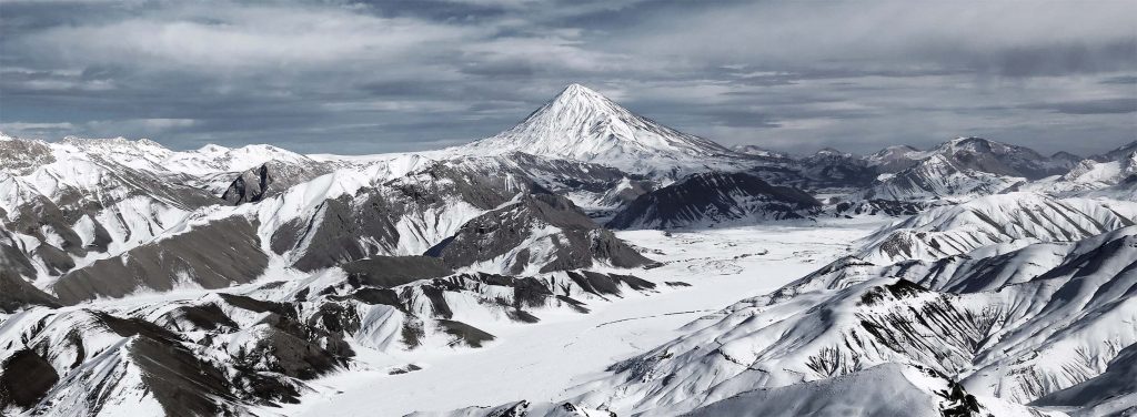
Damavand peak is the name of a mountain in north of Iran plateau , Damavand is also the highest peak of Elburz(Alborz) mountain range. Mount Damavand is a potentially active volcano and the highest peak in Iran also the highest volcano in Asia (about 5610m).
Damavand peak Location:
It is between Tehran and the southern coast of the Caspian Sea , in Amol County, Mazandaran Province, 69 km northeast of the city of Tehran and 62km southwest of Amol county.
Damavand as a volcano:
Damavand peak is a potentially active volcano , the first volcanic eruption of this mountain estimated on 1.78 million years ago. But maximum eruption refer to about 600000 to 280000 years ago. The last important eruption that made Damavand a high mountain was occurred about 10000 years ago.
Crater diameter is about 400 meters and it’s covered by ice and hard snow all the time.
There are lots of hot springs on the lower slopes (biggest one in Ab-e Garm village in Larijan region) and hot sulfur gases emerging near the crater.
Damavand highlights:
- The 12th most prominent peakin the world.
- The third most prominent in Asia after Mount Everest and Puncak Jaya.
- The highest volcanic mountain in Asia, and part of the Volcanic Seven Summits mountaineering challenge.
Possible activities: Cultural visit , Cycling , Trekking
Damavand peak routes:
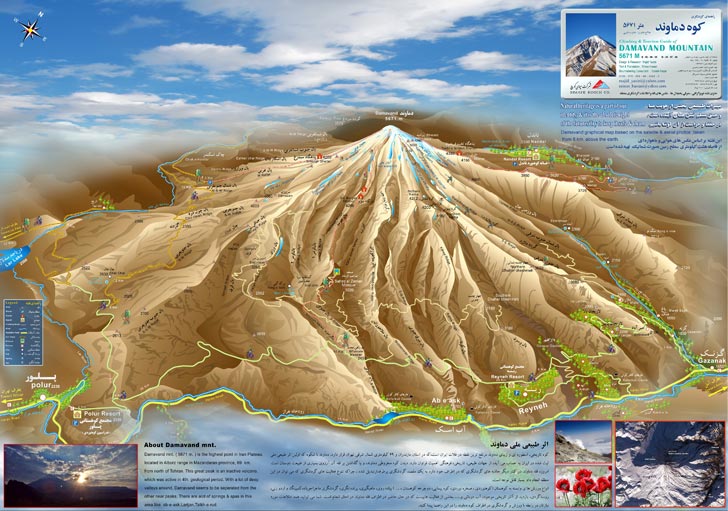
There are about 16 known routes to the summit with different level of difficulty, risk and accessibility but four routes of them have shelter and hut in midway and also are more safe and easy :
Southern, Northern, Northeastern and western routes.
Here I give you some information about this routes:
Southern route:
The most popular and also oldest and easiest route , which has steps and a camp midway called Saheb-e Zaman mosque at 3120m and Bargah Sevom Camp/Shelter at 4,256 m .
You can access to this route by 2 hours driving from Tehran along Haraz road to Larijan region. Haraz road is one of the main roads that connect Tehran to Caspian sea.
You can access to southern ridge of Damavand from two villages in Larijan: Polur(2200m) and Reyneh(2300m).
There is a road between Polur and Rineh and in the middle of this road at 2450 high there is a parking that is open only in summer and in winter you should start trekking from this point. First camp is Saheb-e Zaman mosque at 3050m (end of road) and summer start point for trekking .
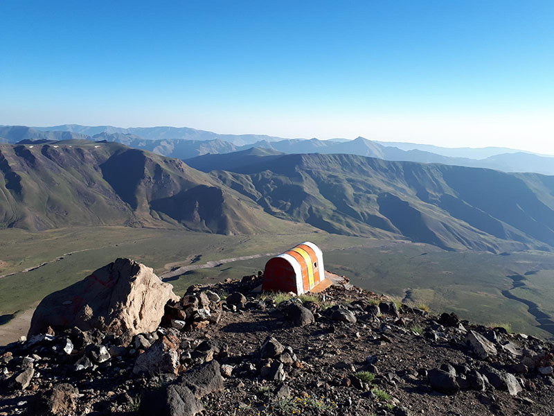
The last camp is Bargah Sevom at 4256m . in this area there is a big Hut equipped by kitchen , shop , toilet and also there is an old shelter and plenty of tent place.
- The nearest village to the starting point : Rineh (2300m) , 90 km driving from Tehran
- Trekking start point : Saheb-e Zaman mosque /Goosfandsara (3050m) , 13 km from Rineh
- Last camping area : Bargah sevom hut (4256m)
Western route:
This route is the second popular route of Damavand , To access this route you should drive along Haraz road to Polur then dive by 4WD on a dirt road about 1 hours to start point of western road(3250m). there is a big shelter with 2 floor on 4200m high of this route .
- The nearest village to the starting point : Polur (2300m) , 70 km driving from Tehran
- Trekking start point :Mountaineering Parking area (3250m) , 45 km from Polur
- Last camping area : Simorgh hut (4100m)
Northeast route :
This route is much longer than other routes . It starts from the village of Hajidela or Nandal in the north of the peak and after crossing the plain, it reaches the side of Takht-e Fereydoon.
If you are planning to climb the legendary roof of Iran, we suggest you the northeast front and Nandal village because the beauty of this part is exemplary and you will not find it anywhere else.
- The nearest village to the starting point : Hajidela / Nandal (2300m) , 130 km driving from Tehran
- Trekking start point : Gardaneh Sar (2950m) , 9 km from village
- Last camping area : Takht-e Fereydoon (4380m)
North route :
One of the most technical popular route of Damavand is Northern route . It starts from the village of Nandal in the north of the peak and after crossing the Nandal plain, it reaches the beginning of Northern ridge.
- The nearest village to the starting point : Nandal (2300m) , 130 km driving from Tehran
- Trekking start point : Nandal village (2300m)
- First camping area : First Shelter (3900m)
- Last camping area : Second Shelter (4800m)