Damavand packing list
Train for climbing mount Damavand
How hard is it to climb Damavand?
volcanic seven summits challenge
mount Damavand facts

Damavand mount ,Why should you climb it ?
Damavand peak routes
Damavand tour price
Damavand mountain weather
Nandal village
6 Tips for Damavand Mount acclimatization

Twelve hiking trails in Iran that must be visited
6 BEST ROUTE TO CLIMB DAMAVAND

Introduction
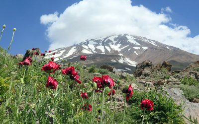
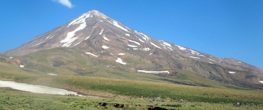
Damavand peak is a semi-active volcano with a height of 5610 meters.
Mount Damavand is the highest peak of the Iranian plateau as well as the highest volcano in Asia and one of the volcanic seven summits challenge.
There are 16 known routes to climb Damavand mount, because of having this amount of climbing route it is a unique mountain in Iran .
In this article, we intend to briefly explain 6 of the best routes to climb Damavand.
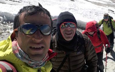
Persiatrek Company with professional mountain guides in Iran can guide you in climbing Damavand Peak from any of these routes.
1- southern route
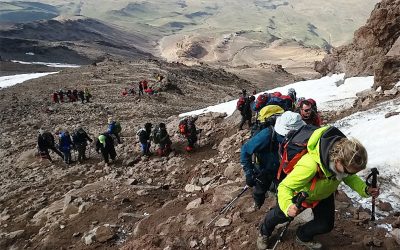
Southern route is the easiest route for climbing mount Damavand therefore it is the most popular route to climb it.
Advantages of climb Damavand from southern route:
- The simplicity of the route and no need for technical equipment to climb (crampons, ropes, etc.)
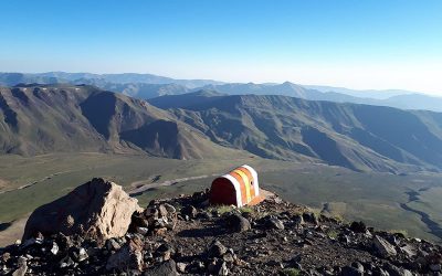
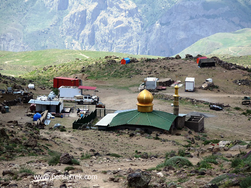
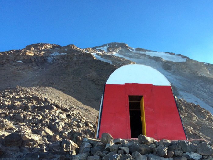
- There is a big Hut (Bargah sevvom) at elevation of 4260m which has facilities such as private rooms ,beds, restaurant and bathroom.
- It is possible to use mule and porter to carry loads
- Being suitable for skiing and not having the risk of avalanche
- Having a helicopter pad also the possibility of faster rescue compare with other routes .
- Proximity to the starting point of the climb to the city of Tehran (2 hours drive and about 100 km)
The last village before trekking start point : Rineh(2100m) / Polur (2300m)
Distance from the village to the beginning of the climb (by car): 20 kilometers
The trekking start point: Gosfandsera (Sahib Al Zaman Mosque) (3050m)
Hut / Shelter : hut( Bargah sevvom) (4260 meters)
Difficulty of the route: simple trekking. No glacier
Skiing: the possibility of climbing & descending with skis from the beginning of the climb to the summit
2- Northeast route :
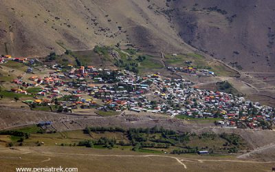
This route is the second easiest route to climb Damavand . It starts from the village of Hajidela or Nandal in the north of the peak and after crossing the plain, it reaches the side of Takht-e Fereydoon
Advantages of climb Damavand from northeast route:
This route is easy and not technical
This route is cleaner and quieter than the southern route
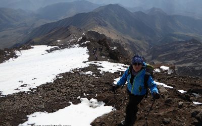
Due to its location in the north of Damavand peak, the path is green and beautiful
There is a shelter at an altitude of 4380 meters
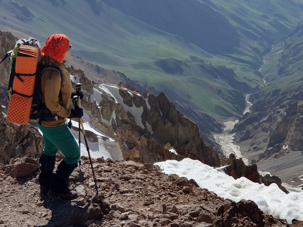
It is possible to see the largest and most beautiful Damavand glacier (Yekhar valley) from this route
- The last village before trekking start point : Hajidela / Nandal (2300m) , 130 km driving from Tehran
- Distance from the village to the beginning of the climb (by car): 10 kilometers
- The trekking start point: Gardaneh Sar (2950m)
- Hut / Shelter : Shelter Takht-e Fereydoon (4380m)
- Difficulty of the route: simple trekking. No glacier but snow field
- Skiing: the possibility of climbing & descending with skis from the beginning of the climb to the summit
3- western route :
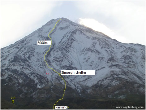
The western route is the second most popular route of Damavand peak. The proximity of the starting point of this route to the village of Polur and ofcorce to the city of Tehran, as well as having a large and well-equipped shelter, are the reasons for the popularity of this route.
Advantages of climb Damavand from western route:
- The second largest shelter of Damavand peak (Simorgh shelter) is located on this route
- This route starts from Lar National Park, which is one of the most beautiful national parks in Iran
- Unlike the southern and northeastern routes, there are no sulfur springs at the end of this route, which facilitates the ascent
- The western route and the northwestern route have the shortest climbing route and the distance to Damavand peak
- The last village before trekking start point : Polur (2300m) , 80 km driving from Tehran
- Distance from the village to the beginning of the climb (by 4wd car): 45 kilometers
- The trekking start point: Mountaineering Parking area (3250m)
- Hut / Shelter : Shelter Simorgh (4100m)
- Difficulty of the route: simple trekking. No glacier
- Skiing: the possibility of climbing & descending with skis from the beginning of the climb to the summit
4- Northern route :
The northern route is the most difficult route of Damavand peak among the routes that have shelters.
Being on the north side and the passing of two glaciers, as well as the steep slope of this route, are among the reasons for the difficulty of this route. This route, like the northeast route, starts from Nandal village
Advantages of climb Damavand from western route:
- Having two shelters at the height of 3900 and 4800 meters
- This route is the most technical route among the normal routes of Damavand peak
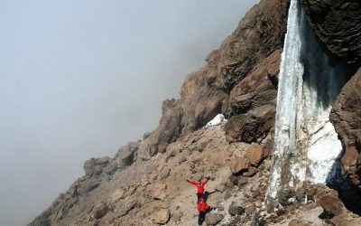
- Some of the most prominent and huge permanent glaciers in Iran, such as Khortab Sar, Dobi Sel, Yechar, Siuleh, and Arushok are located on the northern slopes of Mount Damavand, and it is very magnificent to see them.
- The last village before trekking start point : Hajidela / Nandal (2300m) , 130 km driving from Tehran
- Distance from the village to the beginning of the climb (by 4wd car): 0 kilometers
- The trekking start point: Nandal (2300m)
- Hut / Shelter : First shelter (3900m) and second shelter (4800m)
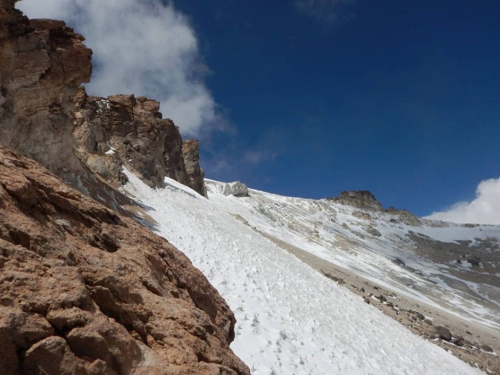
- Difficulty of the route: difficult hiking. passing the glacier
- Skiing: not recommend for skiing
5- Northwestern route (Yal-e Sardagh):
Sardagh Ridge means: the point and ridge connecting Mount Damavand to Alborz Mountain is located in the northwest ascent route, and climbers climb the highest ridge of Damavand on this route. This route is one of the most pristine routes to climb Damavand Peak.
Advantages of climb Damavand from Northwestern route
route:
- The northwest route and the west route have the shortest climbing routes to Damavand.
- It is possible to access the origin of the ascent at an altitude of 3,600 meters with two-wheel drive vehicles
- Among all Damavand routes, the northwest route has the highest starting point because Yaal Dag is the connecting point of Damavand with the Alborz mountain range.
- The northwest route is located near the important and permanent glaciers of Damavand, such as Siuoleh and Dobisel, and has wonderful views and effects.
- The last village before trekking start point : Polur (2300m) , 80 km driving from Tehran
- Distance from the village to the beginning of the climb (by 4wd car): 60 kilometers
- The trekking start point: Sardagh area (3600m)
- Hut / Shelter : no shelter
- Difficulty of the route: hard trekking. passing snow fields
- Skiing: the possibility of climbing & descending with skis from the beginning of the climb to the summit but reaching to start point is long and difficult
Eastern routes
The eastern face of Damavand has 3 clear ascent routes, which are, after ignoring the internal routes of Yakhar valley, from north to south:
First: Malar ridge
Second: Vazminchal ridge
Third: Ab-e Garm ridge
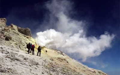
All three routes meet at an altitude between 5200 and 5400 and enter Damavand peak from the east of Sulfur hill.
The two main eastern glaciers are located between the ridges of these 3 routes.
Advantages of climb Damavand from eastern route:
The eastern routes of climbing Damavand peak are among the most pristine and less frequented routes of climbing Damavand peak, and it can even be said that most of their routes do not have a clear path.
– The origin of the eastern routes is generally less than 2,500 meters, and even in Ghazaneh route, they are about 1,750 meters high, and due to the large height difference with Damavand peak, they are different from other Damavand peak routes.
– Unlike the route of other fronts of Damavand, the ascent of all eastern routes starts from villages and centers with asphalt roads.
– Larijan spa and tourist attractions east of Mount Damavand are located as close as possible to the eastern routes of the ascent and can be used after the ascent.
Main eastern route (Yal-e Ab-e garm) :
- The last village before trekking start point : Ab-e garm (2150m) , 110 km driving from Tehran
- Distance from the village to the beginning of the climb (by 4wd car): 0 kilometers
- The trekking start point: Ab-e garm village (2150m)
- Hut / Shelter : no shelter
- Difficulty of the route: hard trekking. passing glacier
- Skiing: the possibility of climbing & descending with skis from the beginning of the climb to the summit